HALO wind lidar
| PI | Mika Komppula |
| Participant | Finnish Meteorological Institute |
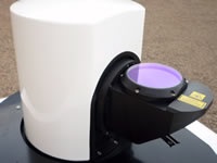
A HALO wind lidar will be used to estimate the turbulence within the planetary boundary layer in order to identify strong convection cases, capable of dispersing marine particles at high altitudes (to be detected by EMORAL). The HALO instrument is provided by the Finish Meteorological Institute (FMI).
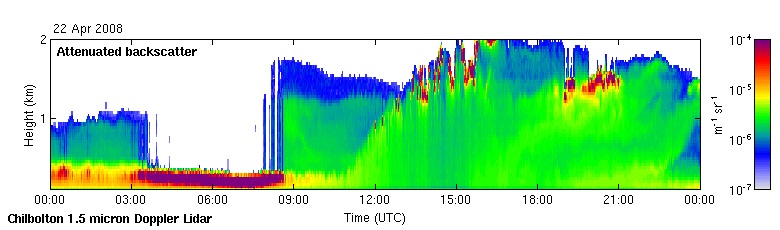
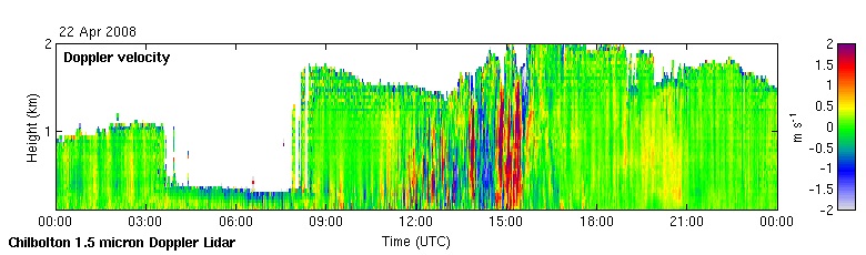
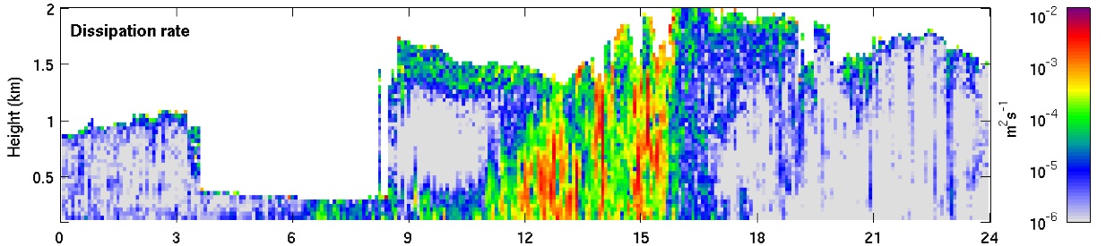
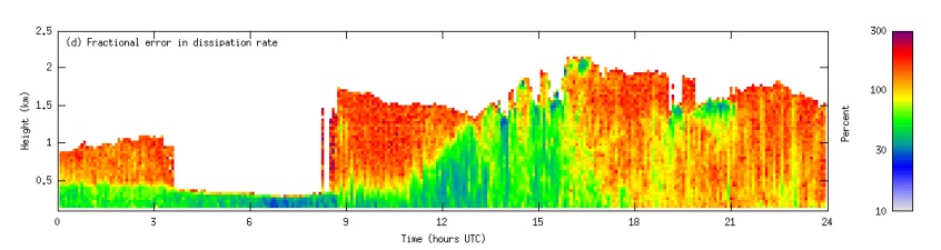
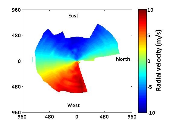
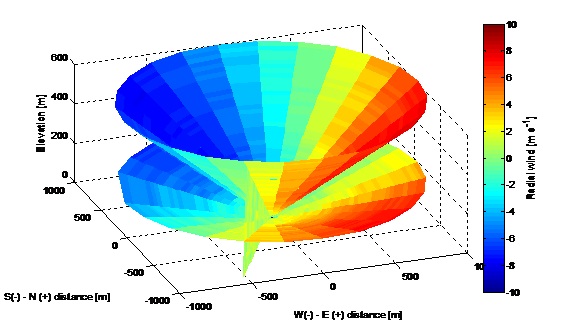
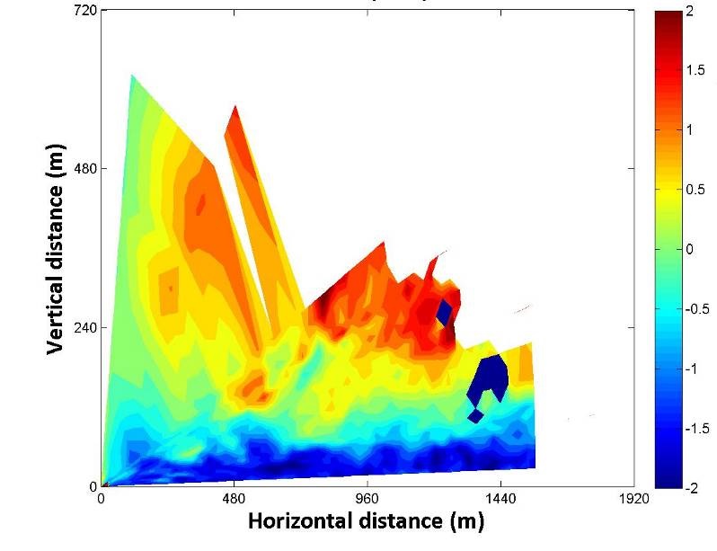
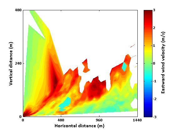
The Doppler lidar, with an operational wavelength at 1.5μm, has a vertical resolution of 30m and measures the attenuated aerosol backscatter, doppler velocity and dissipation rate. Every 10min the lidar performs a conical scanning and measures the three wind components, providing information for the wind speed and wind direction. Distribution of the wind speed at a certain distance away from the lidar can be retrieved in the vertical and horizontal direction while the lidar operates under the scanning mode.
Products
- Three wind components, wind speed, wind direction with associated uncertainties.
- Turbulence: attenuated backscatter at 1.5μm, doppler velocity and dissipation rate.

Recent measurements
| Measurement | Start time | Duration |
|---|---|---|
| HALO realtime | Sept. 9, 2014, midnight | 1 day |
| HALO | July 10, 2014, midnight | 1 day |
| HALO | July 9, 2014, midnight | 1 day |
| HALO | July 8, 2014, midnight | 1 day |
| HALO | July 7, 2014, midnight | 1 day |
| HALO | July 6, 2014, midnight | 1 day |
| HALO | July 5, 2014, midnight | 1 day |
| HALO | July 4, 2014, midnight | 1 day |
| HALO | July 3, 2014, midnight | 1 day |
| HALO | July 2, 2014, midnight | 1 day |
| HALO | July 1, 2014, midnight | 1 day |
| HALO | June 30, 2014, midnight | 1 day |
| HALO | June 29, 2014, midnight | 1 day |
| HALO | June 28, 2014, midnight | 1 day |
| HALO | June 27, 2014, midnight | 1 day |
| HALO | June 26, 2014, midnight | 1 day |
| HALO | June 25, 2014, midnight | 1 day |
| HALO | June 24, 2014, midnight | 1 day |
| HALO | June 23, 2014, midnight | 1 day |
| HALO | June 22, 2014, midnight | 1 day |
| HALO | June 21, 2014, midnight | 1 day |
| HALO | June 20, 2014, midnight | 1 day |
| HALO | June 19, 2014, midnight | 1 day |
| HALO | June 18, 2014, midnight | 1 day |
| HALO | June 17, 2014, midnight | 1 day |
Recent activity
News
- ITaRS participation in CHARADMExp (Jul 10th)
- UAV measurements (video) (Jul 1st)
- Cyprus Institute UAVs are heading to Sitia's airport (Jun 26th)
- Saharan dust is approaching (Jun 24th)
- Getting prepared for UAV flights over Crete (Jun 23rd)
Uploaded data
- HALO realtime (Sep 9th)
- FLEXPART (Jul 31st)
- WRF WIND (Jul 31st)
- WRF WIND (Jul 31st)
- WRF WIND (Jul 31st)
CHARADMexp campaign is funded by the European Space Agency.
CHARADMexp is supported by the BEYOND Centre of Excellence, in the frame of the satellite cal/val activities performed by the Centre. LIVAS climatology as well as the smoke dispersion and dust services provided by BEYOND will be validated through the CHARADMexp campaign.
ACTRIS provides support to CHARADMexp participants by offering access to the Finokalia research facilities through the Transnational Access activity of the Network.