Getting prepared for UAV flights over Crete Published: June 23, 2014, 3:29 p.m.

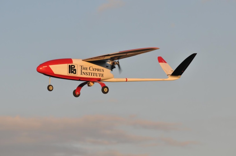
After the successful installation of CHARADMexp ground-based instrumentation at Finokalia, we are shifting our efforts towards the UAV flights preparations. According to our schedule, the UAV test flights should start on 25th of June and the first campaign flights are expected to take place between June 27 and July 5. The Unmanned Aerial Research Facility (UARF) of the Cyprus Institute has already arrived in Crete and the first instrument preparations have been performed. In collaboration with the aviation authorities in Heraklion, it has been defined that the area around “Pachia Ammos” is most suited for safe UAV operations.
Pachia Ammos is located at a 30 km distance from Finokalia. We do not expect significant horizontal variability of the aerosol loads between the two sites. This is because the extended area selected for CHARADMexp is mostly affected by natural aerosol sources that are expected to have similar impact at both sites. Moreover, the horizontal distance between Finokalia and Pachia Ammos is not considered large enough for altering aerosol distribution, especially because local aerosol sources are absent in the wider area.
In order to ensure the expected aerosol horizontal homogeneity, we have decided in our first CHARADMexp meeting to operate the EMORAL lidar at Pachia Ammos in order to compare with the PollyXT measurements that are performed at Finokalia on a 24/7 basis. EMORAL will be additionally equipped with a Microtops mobile photometer, and appropriate in-situ instrumentation for aerosol size distribution and concentration measurements. Detailed intercomparison studies between EMORAL vs. PollyXT and Microtops vs. AERONET are currently under progress to ensure the consistency between the instruments.
Recent activity
News
- ITaRS participation in CHARADMExp (Jul 10th)
- UAV measurements (video) (Jul 1st)
- Cyprus Institute UAVs are heading to Sitia's airport (Jun 26th)
- Saharan dust is approaching (Jun 24th)
- Getting prepared for UAV flights over Crete (Jun 23rd)
Uploaded data
- HALO realtime (Sep 9th)
- FLEXPART (Jul 31st)
- WRF WIND (Jul 31st)
- WRF WIND (Jul 31st)
- WRF WIND (Jul 31st)


